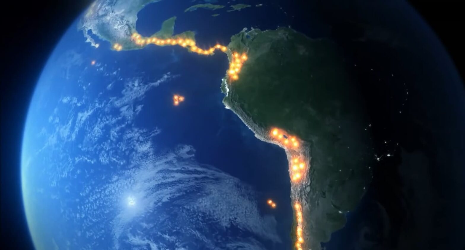
The Ring of Fire encompasses the primary hub of Earth’s volcanic activity, stretching around the Pacific coast and influencing numerous countries across the globe.
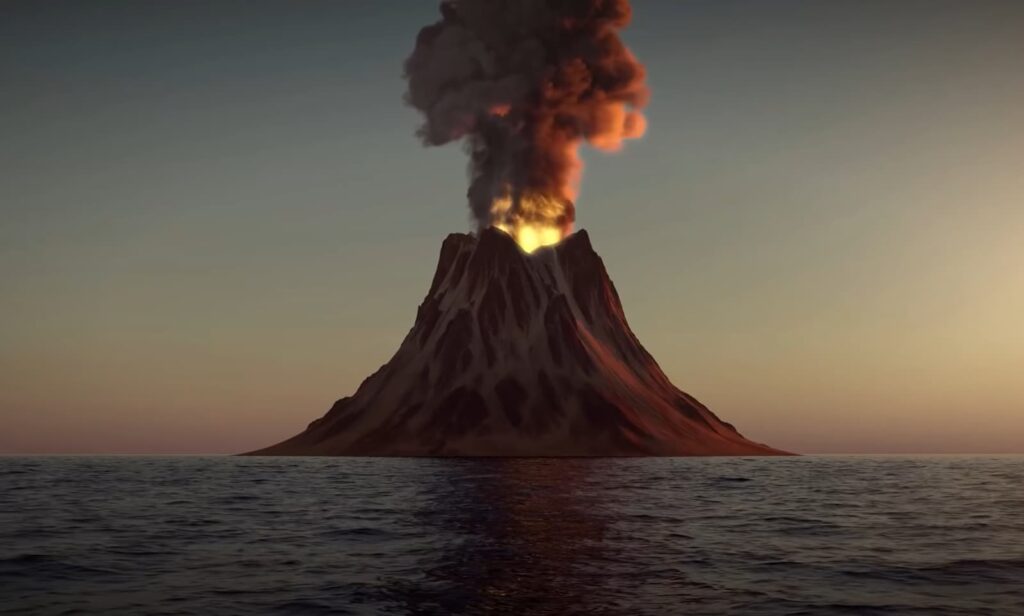
Within this expansive ring, scientists have documented a variety of volcanic structures, including shield volcanoes, stratovolcanoes, and submarine mounts. Some of these formations remain entirely submerged beneath the ocean’s surface, while others, such as Mt. St. Helens in Washington state, Plosky Tolbachik in eastern Russia, and Ojos del Salado in the Andes Mountains, tower above ground level. Notably, Ojos del Salado holds the distinction of being the world’s highest active volcano, soaring to approximately 22,615 feet (6,893 meters) above sea level.
The Global Impact of the Ring of Fire
The Ring of Fire encompasses a vast network of underwater volcanoes encircling the Pacific Ocean, contributing to a myriad of volcanic eruptions and seismic activities. This expansive geological phenomenon, often likened to a horseshoe, spans approximately 25,000 miles (40,000 km) in length and extends about 310 miles wide (500 km), although its dimensions may vary depending on the delineation of active zones by geologists. Within this region lie over 450 volcanoes, each playing a crucial role in shaping the Earth’s surface.
Included within the boundaries of the Ring of Fire are the Pacific coastlines of South America and North America, spanning from the Bering Strait through Japan and reaching as far south as New Zealand. While scientists estimate the Ring of Fire’s existence for over 35 million years, the underlying plate tectonic activity predates this duration by far.
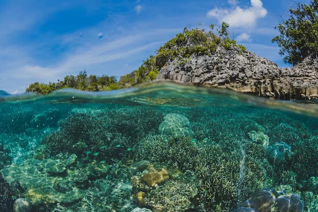
Delving into the depths of the Ring of Fire unveils its profound impact on global geology and ecology, shaping landscapes, influencing climates, and posing significant challenges for communities dwelling in its vicinity. Understanding this complex geological system is vital for predicting and mitigating the potential hazards it presents to human populations and the environment.
The Formation of the Ring of Fire
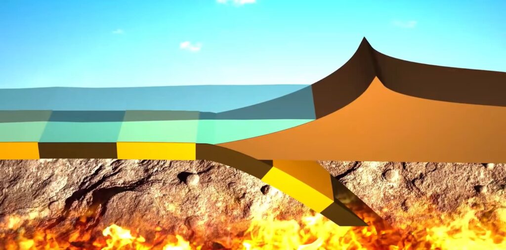
The awe-inspiring phenomenon known as the Ring of Fire owes its existence to the intricate dance of Earth’s tectonic plates. Hidden beneath the vast expanse of the Pacific Ocean, these plates collide and undergo a transformative process of destruction. Termed as “lithospheric plates,” these regions of the Earth’s crust and upper mantle converge at specific points, giving rise to what are known as convergent plate boundaries. It is within these boundaries that the relentless forces of nature come to play.
As the collision unfolds, magma surges upwards, breaching the Earth’s surface. This volcanic activity has been instrumental in shaping the iconic landscapes of the Ring of Fire. Towering volcanoes, emblematic of this region’s geological vigor, stand as testament to the ongoing processes beneath the Earth’s crust.
Yet, the impact of these geologically active regions extends beyond the realm of volcanism. Along these convergent plate boundaries, trenches and basins are carved into the Earth’s surface. These chasms plunge to the deepest depths of the Earth’s oceans, with notable examples including the Tonga Trench and the Mariana Trench. These submerged wonders serve as stark reminders of the immense forces at play, shaping our planet’s ever-evolving landscape.
The Origins of the Ring of Fire
The narrative of the Ring of Fire extends far back into the annals of scientific inquiry, tracing its origins to the early 19th century. It was during this period that pioneering volcanologists began to discern the telltale signs of volcanic activity scattered across the expanse of the Pacific Ocean. Notably, in G.P. Scrope’s seminal work, “Considerations on Volcanoes,” there emerges a vivid portrayal of the volcanic phenomena that would later coalesce into what we now recognize as the Ring of Fire.
By the turn of the 20th century, a nascent understanding of this interconnected network of volcanoes began to take shape. As early as 1906, astute observers began to conceptualize the collective presence of these volcanic entities as a cohesive “ring.” However, it wasn’t until the advent of the 1960s that scientists made significant strides in unraveling the enigmatic origins of these volcanic formations.
It was during this pivotal era that the broader theories of plate tectonics emerged, providing a comprehensive framework to elucidate the mechanisms behind the formation of the Ring of Fire. With each passing decade, our understanding of this geologically dynamic region continues to evolve, shedding light on the intricate interplay of tectonic forces that have shaped our planet’s surface over millennia.
Where Exactly is the Ring of Fire?
The enigmatic phenomenon known as the “Ring of Fire” finds its home nestled within the vast expanse of the Pacific Ocean, where a distinctive circular arrangement of underwater volcanoes captures the imagination of scientists and enthusiasts alike. Yet, pinpointing the precise boundaries of this geological marvel remains a subject of spirited debate among experts.
The contours of this fiery ring are subject to interpretation, with varying perspectives on which regions should be included or excluded. Among the contentious points of discussion are the volcanic clusters surrounding the Antarctic Peninsula and the western reaches of Indonesia. While some geologists advocate for the inclusion of all Indonesian territories within the Ring of Fire, others argue for the exclusion of certain western islands, situating them within alternative geological frameworks such as the Alpide belt or Himalayan orogenic belt.
Despite these disagreements, one fact remains undeniable: the Ring of Fire stands as the second-most active hotspot of underwater volcanic activity on the planet, perpetually reminding us of the Earth’s dynamic and ever-changing nature.
Major Geological Catastrophes in the Pacific Ring of Fire
The Pacific Ring of Fire, a horseshoe-shaped geological disaster zone, has witnessed some of the most catastrophic volcanic eruptions and earthquakes in the last 11,000 years, marking the Holocene Epoch. This area accounts for approximately 90% of the globe’s earthquake activity, showcasing a history of monumental natural disasters that have shaped human and environmental landscapes. Among these, two of the most significant seismic events are highlighted below, illustrating the power and impact of natural forces within this volatile region.
The 1960 Great Chilean Earthquake
- Recorded as the most powerful earthquake in modern history, the 1960 Great Chilean Earthquake struck with a devastating force of 9.5 magnitude;
- Its impact was felt most acutely along the southern coast of Chile, causing widespread destruction over a span of ten minutes;
- Originating near Lumaco, south of Santiago, this seismic event left approximately 2 million people without homes and claimed the lives of about 1,655 individuals.
The earthquake also set off a massive tsunami, generating waves that soared above thirty-five feet and traveled vast distances, reaching as far as 10,000 kilometers away to affect communities in New Zealand and the Philippines. The city of Valdivia bore the brunt of this catastrophe, lending its name to this historic seismic event.
The 2011 Tōhoku Earthquake and Tsunami in Japan
- On March 11, 2011, Japan faced its most severe earthquake since records began;
- With a magnitude of between 9.0 and 9.1, the quake’s epicenter was located off the Oshika Peninsula, unleashing a devastating tsunami and causing widespread destruction over a period of six minutes;
- This event stands as Japan’s most formidable earthquake and ranks as the fourth most powerful in the world since the advent of modern seismic measurement tools.
The ensuing tsunami waves, some reaching heights of up to 133 feet (40.5 meters), resulted in tragic loss, with a 2021 report revealing that 19,747 people lost their lives, alongside thousands more missing or injured. The Tōhoku earthquake and tsunami underscore the immense power of natural forces at play within the Pacific Ring of Fire, marking a significant chapter in the region’s geological and human history.
Frequently Asked Questions
The term “Ring of Fire” is derived from the arrangement of volcanoes encircling the Pacific Ocean, resembling a horseshoe more than a perfect circle. This region boasts approximately 450 volcanoes, with many submerged beneath the ocean.
Countries with coastlines bordering the Pacific Ocean and included in the Ring of Fire are Indonesia, Australia, the Philippines, Ecuador, Guatemala, the United States, Canada, Russia, Bolivia, Chile, and Japan, among others.
Yes, the Ring of Fire experiences ongoing volcanic activity, with numerous volcanoes being active at any given time. Some of these volcanic eruptions occur underwater.
Conclusion
The Pacific Ring of Fire is an imposing global phenomenon that holds crucial insights into our planet’s geological and biological systems. Engulfing countless islands and nations within its arc, it plays a pivotal role in shaping our Earth’s landscape, influencing seismic activities, and nurturing the ocean’s biodiversity. While its inherent unpredictability poses tremendous challenges, it simultaneously provides immense opportunities for scientific exploration and discovery.